Hurricane Barbara 2025: First Pacific Storm Raises Concerns
Latest Updates


visionariesnetwork Team
10 June, 2025
Environment Power and Clean Energy
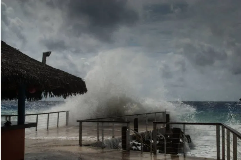
Tropical Storm Barbara became a hurricane on Monday, June 9, 2025, according to the National Hurricane Center (NHC). Now officially classified as Hurricane Barbara 2025, the storm is the first hurricane of this year’s Pacific season, bringing with it early signs of what could be an active summer for tropical weather.
Barbara formed off the coast of southwestern Mexico over the weekend and strengthened rapidly into a Category 1 hurricane by Monday afternoon. With maximum sustained winds of 85 mph and gusts nearing 100 mph, Hurricane Barbara 2025 is currently churning west-northwest over open ocean, moving at about 14 mph.
Will Hurricane Barbara Hit the U.S.?
As of now, Hurricane Barbara 2025 is not expected to pose a direct threat to the U.S. mainland. The storm remains far off the coast and is forecast to continue moving away from land. However, its wide influence may generate high surf, dangerous rip currents, and minor coastal flooding in parts of Baja California and potentially southern California by late this week.
The National Hurricane Center has not issued any coastal watches or warnings for U.S. regions. Still, experts recommend keeping an eye on the forecast in case the storm’s path shifts unexpectedly.
“Although Barbara is currently tracking away from the coast, we always advise the public to stay informed during hurricane season,” said Dr. Elena Ruiz, senior forecaster at the NHC.
Why Barbara Formed Early in the Season
While hurricanes forming in early June are relatively rare, they are not unheard of in the Eastern Pacific, where warm ocean temperatures and favorable atmospheric conditions can speed up storm development. The official Eastern Pacific hurricane season began on May 15, making Barbara an early but not unprecedented event.
Meteorologists note that Hurricane Barbara 2025 rapidly evolved from a tropical depression into a hurricane in just over 24 hours—a sign of favorable storm-building conditions in the Pacific.
Could It Influence U.S. Weather?
Even though it may not make landfall, Barbara’s wide wind field and moisture plume could influence weather patterns in the southwestern U.S., especially in states like Arizona and New Mexico, bringing scattered rainfall and slightly cooler temperatures. Some weather models indicate remnants of the storm could increase humidity and lead to thunderstorms later in the week.
Climate experts are also warning of a potentially above-average hurricane season, driven by neutral El Niño conditions and warmer-than-normal sea surface temperatures.
A Reminder to Stay Prepared
Whether or not Barbara impacts the U.S. directly, it’s a strong reminder that hurricane season is underway. Experts urge residents in coastal regions—both Pacific and Atlantic—to review their emergency plans, update disaster kits, and stay tuned to alerts from official weather agencies. “Every storm is different, and every season can surprise us,” Dr. Ruiz emphasized. “Preparedness now means safety later.”
Browse our most recent publications